Difference between revisions of "Kettle Point 44, Lambton, Ontario"
m |
m |
||
| (One intermediate revision by the same user not shown) | |||
| Line 4: | Line 4: | ||
| settlement_type = Ingidenous Reserve | | settlement_type = Ingidenous Reserve | ||
| nickname = | | nickname = | ||
| − | | | + | | flag_size = 120x100px |
| − | | subdivision_type3 = First Nation | + | | pushpin_label = Kettle Point 44 |
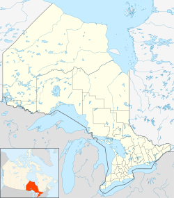
| + | | coordinates = {{coord|43|12|N|82|00|W|region:CA-ON|display=inline,title}} | ||
| + | | image_map = {{Location map | Ontario municipal districts | ||
| + | | width = 250 | ||
| + | | lat_deg = 43 | lat_min = 12 | lat_sec = 0 | lat_dir = N | ||
| + | | lon_deg = 82 | lon_min = 00 | lon_sec = 0 | lon_dir = W | ||
| + | | label = Kettle Point 44}} | ||
| + | | subdivision_type = Country | ||
| + | | subdivision_name = [[wikipedia:Canada|Canada]] | ||
| + | | subdivision_type1 = Province | ||
| + | | subdivision_name1 = [[wikipedia:Ontario|Ontario]] | ||
| + | | subdivision_type2 = County | ||
| + | | subdivision_name2 = [[wikipedia:Lambton County, Ontario|Lambton]] | ||
| + | | subdivision_type3 = First Nation | ||
| subdivision_name3 = Chippewas of Kettle and Stony Point | | subdivision_name3 = Chippewas of Kettle and Stony Point | ||
| established_title = Settled | | established_title = Settled | ||
| established_date = 1827 | | established_date = 1827 | ||
| established_title2 = Formed | | established_title2 = Formed | ||
| − | | established_date2 = | footnotes = For infobox source see<ref>{{cite web | + | | established_date2 = |
| + | | area_total_km2 = | ||
| + | | area_land_km2 = 9.20 | ||
| + | | area_water_km2 = | ||
| + | | area_footnotes = | ||
| + | | population_as_of = 2011 | ||
| + | | population_footnotes = | ||
| + | | population_total = 936 | ||
| + | | population_density_km2=101.7 | ||
| + | | timezone = [[wikipedia:Eastern Time Zone|EST]] | ||
| + | | utc_offset = -5 | ||
| + | | timezone_DST = [[wikipedia:Eastern Time Zone|EDT]] | ||
| + | | utc_offset_DST = -4 | ||
| + | | postal_code_type = [[wikipedia:Postal codes in Canada|Postal Code]] | ||
| + | | postal_code = N0N 1J1 | ||
| + | | area_code = [[wikipedia:Area codes 519 and 226|519 and 226]] | ||
| + | | elevation_footnotes = | ||
| + | | elevation_m = | ||
| + | | website = [http://www.kettlepoint.org/ www.kettlepoint.org] | ||
| + | | footnotes = For infobox source see<ref>{{cite web | ||
| title = Chippewas of Kettle and Stony Point First Nation | | title = Chippewas of Kettle and Stony Point First Nation | ||
| publisher = Wikipedia | | publisher = Wikipedia | ||
| url = https://en.wikipedia.org/wiki/Chippewas_of_Kettle_and_Stony_Point_First_Nation | | url = https://en.wikipedia.org/wiki/Chippewas_of_Kettle_and_Stony_Point_First_Nation | ||
| − | | accessdate = 2020- | + | | accessdate = 2020-09-15}}</ref> |
}}__TOC__ | }}__TOC__ | ||
== Subdivision Well Data == | == Subdivision Well Data == | ||
Latest revision as of 20:28, 15 September 2020
| Kettle Point 44 | |
|---|---|
| Ingidenous Reserve | |
| Kettle Point Indigenous Reserve No. 44 | |
| Country | Canada |
| Province | Ontario |
| County | Lambton |
| First Nation | Chippewas of Kettle and Stony Point |
| Settled | 1827 |
| Area | |
| • Land | 9.20 km2 (3.55 sq mi) |
| Population (2011) | |
| • Total | 936 |
| • Density | 101.7/km2 (263/sq mi) |
| Time zone | EST (UTC-5) |
| • Summer (DST) | EDT (UTC-4) |
| Postal Code | N0N 1J1 |
| Area code(s) | 519 and 226 |
| Website | www.kettlepoint.org |
| For infobox source see[1] | |
Contents
Subdivision Well Data
| Well ID | Operator Name | Spud Date | Well Status |
|---|---|---|---|
| N000632 | Wilson - Sullivan Development Co. | 1935-05-01 | Abandoned Well |
For data sources see[2]
References
- ↑ "Chippewas of Kettle and Stony Point First Nation". Wikipedia. Retrieved 2020-09-15.
- ↑ "OGSR Library - Wells". Oil, Gas & Salt Resources Library. 2019-06-13. Retrieved 2020-08-07.
