Difference between revisions of "Wilmot, Waterloo, Ontario"
m |
m |
||
| Line 43: | Line 43: | ||
| publisher = Wikipedia | | publisher = Wikipedia | ||
| url = https://en.wikipedia.org/wiki/Wilmot,_Ontario | | url = https://en.wikipedia.org/wiki/Wilmot,_Ontario | ||
| − | | accessdate = 2020- | + | | accessdate = 2020-09-15}}</ref> |
}}__TOC__ | }}__TOC__ | ||
== Subdivision Well Data == | == Subdivision Well Data == | ||
Latest revision as of 20:54, 15 September 2020
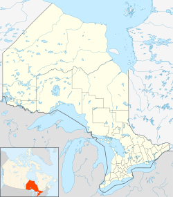
| Wilmot | |
|---|---|
| Township (lower-tier) | |
| Township of Wilmot | |
| Country | Canada |
| Province | Ontario |
| Region | Waterloo |
| Settled | 1822 |
| Incorporated | 1850 |
| Area | |
| • Land | 263.72 km2 (101.82 sq mi) |
| Elevation | 370 m (1,210 ft) |
| Population (2016) | |
| • Total | 20,545 |
| • Density | 77.9/km2 (202/sq mi) |
| Time zone | EST (UTC-5) |
| • Summer (DST) | EDT (UTC-4) |
| Postal Code | N3A |
| Area code(s) | 519 and 226 |
| Website | www.wilmot.ca |
| For infobox source see[1] | |
Contents
Subdivision Well Data
| Well ID | Operator Name | Spud Date | Well Status |
|---|---|---|---|
| T008050 | Shiningbank Energy Ltd. | 1993-10-12 | Abandoned Well |
For data sources see[2]
References
- ↑ "Wilmot, Ontario". Wikipedia. Retrieved 2020-09-15.
- ↑ "OGSR Library - Wells". Oil, Gas & Salt Resources Library. 2019-06-13. Retrieved 2020-08-07.
