Difference between revisions of "Asotin County, Washington"
m |
m |
||
| Line 23: | Line 23: | ||
| publisher = Wikipedia | | publisher = Wikipedia | ||
| url = https://en.wikipedia.org/wiki/Asotin_County,_Washington | | url = https://en.wikipedia.org/wiki/Asotin_County,_Washington | ||
| − | | accessdate = 2020- | + | | accessdate = 2020-11-04}}</ref> |
}}__TOC__ | }}__TOC__ | ||
== County Well Data == | == County Well Data == | ||
Latest revision as of 16:50, 4 November 2020
| Asotin County, Washington | |
|---|---|
|
Asotin County Courthouse | |
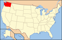
 Location in the state of Washington | |
 Washington's location in the U.S. | |
| Founded | October 27, 1883 |
| Seat | Asotin |
| Largest city | Clarkston |
| Area | |
| • Total | 641 sq mi (1,660 km2) |
| • Land | 636 sq mi (1,647 km2) |
| • Water | 4.4 sq mi (11 km2), 0.7% |
| Time zone | Pacific: UTC-8/-7 |
| Website | www.co.asotin.wa.us |
| Footnotes: For infobox source see[1] | |
Contents
County Well Data
| Well ID | Operator Name | Well Type | Well Status |
|---|---|---|---|
| 46-003-00001 | LEWISTON-CLARKSTON OIL AND GAS CO. | OIL & NATURAL GAS WELL | UNKNOWN WELL |
| 46-003-00002 | LEWISTON-CLARKSTON OIL AND GAS CO. | OIL & NATURAL GAS WELL | UNKNOWN WELL |
For data sources see[2]
References
- ↑ "Asotin County, Washington". Wikipedia. Retrieved 2020-11-04.
- ↑ "Oil and Natural Gas Wells". Homeland Infrastructure Foundation-Level Data. 2019-09-24. Retrieved 2020-09-12.
