Difference between revisions of "Claiborne County, Mississippi"
m |
m |
||
| Line 24: | Line 24: | ||
| publisher = Wikipedia | | publisher = Wikipedia | ||
| url = https://en.wikipedia.org/wiki/Claiborne_County,_Mississippi | | url = https://en.wikipedia.org/wiki/Claiborne_County,_Mississippi | ||
| − | | accessdate = 2020- | + | | accessdate = 2020-11-04}}</ref> |
}}__TOC__ | }}__TOC__ | ||
== County Well Data == | == County Well Data == | ||
Latest revision as of 19:10, 4 November 2020
| Claiborne County, Mississippi | |
|---|---|
|
Claiborne County courthouse and Confederate Monument in Port Gibson | |
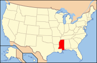
 Location in the state of Mississippi | |
 Mississippi's location in the U.S. | |
| Founded | 1802 |
| Named for | William C. C. Claiborne |
| Seat | Port Gibson |
| Largest city | Port Gibson |
| Area | |
| • Total | 501 sq mi (1,298 km2) |
| • Land | 487 sq mi (1,261 km2) |
| • Water | 14 sq mi (36 km2), 2.8 |
| Time zone | Central: UTC-6/-5 |
| Footnotes: For infobox source see[1] | |
Contents
County Well Data
| Well ID | Operator Name | Well Type | Well Status |
|---|---|---|---|
| 23-021-20016 | ENSIGHT IV ENERGY MANAGEMENT, LLC | OIL & NATURAL GAS WELL | PRODUCING WELL |
For data sources see[2]
References
- ↑ "Claiborne County, Mississippi". Wikipedia. Retrieved 2020-11-04.
- ↑ "Oil and Natural Gas Wells". Homeland Infrastructure Foundation-Level Data. 2019-09-24. Retrieved 2020-09-12.
