Difference between revisions of "Bentleyville, Ohio"
m |
m |
||
| Line 19: | Line 19: | ||
|established_title = | |established_title = | ||
| − | |established_date = | + | |established_date = |
|unit_pref = Imperial | |unit_pref = Imperial | ||
|area_footnotes = | |area_footnotes = | ||
| + | |area_magnitude = | ||
| + | |area_total_km2 = 6.70 | ||
| + | |area_land_km2 = 6.59 | ||
| + | |area_water_km2 = 0.11 | ||
| + | |area_total_sq_mi = 2.59 | ||
| + | |area_land_sq_mi = 2.54 | ||
| + | |area_water_sq_mi = 0.04 | ||
| + | |||
| + | |||
| + | |population_as_of = [[wikipedia:2010 United States Census|2010]] | ||
| + | |population_est = 846 | ||
| + | |pop_est_as_of = 2019 | ||
|population_footnotes = | |population_footnotes = | ||
|elevation_m = 285 | |elevation_m = 285 | ||
| Line 33: | Line 45: | ||
|website = [http://www.villageofbentleyville.com villageofbentleyville.com] | |website = [http://www.villageofbentleyville.com villageofbentleyville.com] | ||
|footnotes = For infobox source see<ref>{{cite web | |footnotes = For infobox source see<ref>{{cite web | ||
| − | | title = Bentleyville, Ohio | + | | title = Bentleyville, Ohio# |
| publisher = Wikipedia | | publisher = Wikipedia | ||
| − | | url = https://en.wikipedia.org/wiki/Bentleyville,_Ohio | + | | url = https://en.wikipedia.org/wiki/Bentleyville,_Ohio# |
| − | | accessdate = | + | | accessdate = 2021-01-12}}</ref> |
| + | |pop_est_footnotes = | ||
}}__TOC__ | }}__TOC__ | ||
| − | + | == Municipality Well Data == | |
{| class="wikitable sortable" width="95%" | {| class="wikitable sortable" width="95%" | ||
!scope="col" | Well ID | !scope="col" | Well ID | ||
| Line 48: | Line 61: | ||
!scope="col" | License Status | !scope="col" | License Status | ||
|- | |- | ||
| − | |}--> | + | | [[34-035-22118]] |
| − | + | | [[CUTTER OIL COMPANY]] | |
| + | | 2012-04-09 | ||
| + | | 2009-07-08 | ||
| + | | Vertical | ||
| + | | Final Restoration | ||
| + | |- | ||
| + | | [[34-035-60131]] | ||
| + | | [[HISTORIC OWNER]] | ||
| + | | | ||
| + | | | ||
| + | | Vertical | ||
| + | | Not Drilled | ||
| + | |- | ||
| + | | [[34-035-60134]] | ||
| + | | [[HISTORIC OWNER]] | ||
| + | | | ||
| + | | | ||
| + | | Vertical | ||
| + | | Not Drilled | ||
| + | |- | ||
| + | |} | ||
| + | For data sources see<ref>{{cite web | ||
| + | | title = Risk Based Data Management System | ||
| + | |publisher = [[Ohio Department of Natural Resources]] | ||
| + | | date = 2020-11-16 | ||
| + | | url = http://wellwiki.org/wiki/Ohio_Oil_and_Gas_Data_Sources | ||
| + | | accessdate = 2020-11-16 }}</ref> | ||
==References== | ==References== | ||
<references/> | <references/> | ||
__NOEDITSECTION__ | __NOEDITSECTION__ | ||
[[Category:Ohio Municipalities]] | [[Category:Ohio Municipalities]] | ||
Latest revision as of 09:26, 12 January 2021
| Bentleyville, Ohio | |
|---|---|
| Village | |
 Location in Cuyahoga County and the state of Ohio. | |
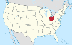
 Location of Ohio in the United States | |
| Country | United States |
| State | Ohio |
| County | Cuyahoga |
| Area | |
| • Total | 2.59 sq mi (6.70 km2) |
| • Land | 2.54 sq mi (6.59 km2) |
| • Water | 0.04 sq mi (0.11 km2) |
| Elevation | 935 ft (285 m) |
| Population (2010) | |
| • Estimate (2019) | 846 |
| ZIP code | 44022 |
| Area code(s) | 440 |
| Website | villageofbentleyville.com |
| For infobox source see[1] | |
Contents
Municipality Well Data
| Well ID | Operator Name | Permit Date | Spud Date | Configuration | License Status |
|---|---|---|---|---|---|
| 34-035-22118 | CUTTER OIL COMPANY | 2012-04-09 | 2009-07-08 | Vertical | Final Restoration |
| 34-035-60131 | HISTORIC OWNER | Vertical | Not Drilled | ||
| 34-035-60134 | HISTORIC OWNER | Vertical | Not Drilled |
For data sources see[2]
References
- ↑ "Bentleyville, Ohio#". Wikipedia. Retrieved 2021-01-12.
- ↑ "Risk Based Data Management System". Ohio Department of Natural Resources. 2020-11-16. Retrieved 2020-11-16.