Difference between revisions of "Nassau County, New York"
m |
m |
||
| Line 1: | Line 1: | ||
| − | {{Infobox U.S. | + | {{Infobox U.S. county |
| − | | county | + | | county = Nassau County |
| state = New York | | state = New York | ||
| − | | ex image | + | | type = [[wikipedia:List of counties in New York|County]] |
| − | | ex image cap | + | | ex image = HempsteadHouseSandsPoint.jpg |
| − | + | | ex image cap = [[wikipedia:Hempstead House|Hempstead House]], part of Sands Point Preserve | |
| − | | seal =Seal of Nassau County, New York.svg | + | | seal = Seal of Nassau County, New York.svg |
| − | | flag=Flag of Nassau County, New York.svg | + | | flag = Official Flag of Nassau County, New York.svg |
| founded = 1899 | | founded = 1899 | ||
| − | | named for = [[wikipedia: | + | | named for = [[wikipedia:House of Nassau|House of Nassau]] |
| − | | seat | + | | seat = [[wikipedia:Mineola, New York|Mineola]] |
| − | | area_land_sq_mi = | + | | largest city = [[wikipedia:Hempstead (village), New York|Hempstead]] |
| − | | area_water_sq_mi = | + | | city type = village |
| − | | area percentage = | + | | area_total_sq_mi = 453 |
| − | | census yr = | + | | area_land_sq_mi = 285 |
| − | | pop = | + | | area_water_sq_mi = 169 |
| − | | | + | | area percentage = 37 |
| + | | census estimate yr = 2019 | ||
| + | | pop = 1356924 | ||
| + | | density_sq_mi = 4766.1 | ||
| time zone = Eastern | | time zone = Eastern | ||
| − | | | + | | area codes = 516 |
| − | |||
| − | |||
| − | |||
| − | |||
| − | |||
| district2 = 3rd | | district2 = 3rd | ||
| district3 = 4th | | district3 = 4th | ||
| district4 = 5th | | district4 = 5th | ||
| − | }} | + | | website = {{URL|www.nassaucountyny.gov}} |
| − | __TOC__ | + | | footnotes = For infobox source see<ref>{{cite web |
| − | == | + | | title = Nassau County, New York |
| + | | publisher = Wikipedia | ||
| + | | url = https://en.wikipedia.org/wiki/Nassau_County,_New_York | ||
| + | | accessdate = 2021-07-19}}</ref> | ||
| + | }}__TOC__ | ||
| + | == County Well Data == | ||
{| class="wikitable sortable" width="95%" | {| class="wikitable sortable" width="95%" | ||
!scope="col" | Well ID | !scope="col" | Well ID | ||
!scope="col" | Municipality | !scope="col" | Municipality | ||
!scope="col" | Operator Name | !scope="col" | Operator Name | ||
| − | !scope="col" | | + | !scope="col" | Permit Date |
!scope="col" | Spud Date | !scope="col" | Spud Date | ||
| − | !scope="col" | | + | !scope="col" | Configuration |
| − | !scope="col" | | + | !scope="col" | Well Status |
| − | + | |- | |
| − | + | | [[31-059-21038]] | |
| + | | [[North Hempstead,_Nassau_County,_New_York|North Hempstead]] | ||
| + | | [[Kingspoint Heights LLC]] | ||
| + | | | ||
| + | | | ||
| + | | Vertical | ||
| + | | Voided Permit | ||
| + | |- | ||
| + | | [[31-059-21039]] | ||
| + | | [[North Hempstead,_Nassau_County,_New_York|North Hempstead]] | ||
| + | | [[Kingspoint Heights LLC]] | ||
| + | | | ||
| + | | | ||
| + | | Vertical | ||
| + | | Voided Permit | ||
| + | |- | ||
| + | | [[31-059-27029]] | ||
| + | | [[Glen Cove,_New_York|Glen Cove]] | ||
| + | | [[Glen Cove Hospital]] | ||
| + | | 2011-10-12 | ||
| + | | 2011-12-13 | ||
| + | | Vertical | ||
| + | | Active | ||
| + | |- | ||
| + | | [[31-059-27030]] | ||
| + | | [[Glen Cove,_New_York|Glen Cove]] | ||
| + | | [[Glen Cove Hospital]] | ||
| + | | 2011-10-12 | ||
| + | | 2011-12-19 | ||
| + | | Vertical | ||
| + | | Active | ||
| + | |- | ||
|} | |} | ||
| + | For data sources see<ref>{{cite web | ||
| + | | title = Public Wells Data | ||
| + | |publisher = New York State Department of Environmental Conservation | ||
| + | | date = 2019-08-09 | ||
| + | | url = http://wellwiki.org/wiki/New_York_Oil_and_Gas_Data_Sources | ||
| + | | accessdate = 2019-08-09 }}</ref> | ||
| + | ==References== | ||
| + | <references/> | ||
__NOEDITSECTION__ | __NOEDITSECTION__ | ||
| − | |||
Latest revision as of 07:01, 19 July 2021
| Nassau County, New York | |||
|---|---|---|---|
|
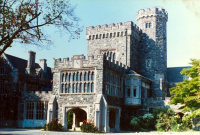
Hempstead House, part of Sands Point Preserve | |||
| |||
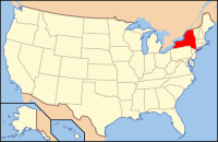
 Location in the state of New York | |||
 New York's location in the U.S. | |||
| Founded | 1899 | ||
| Named for | House of Nassau | ||
| Seat | Mineola | ||
| Largest village | Hempstead | ||
| Area | |||
| • Total | 453 sq mi (1,173 km2) | ||
| • Land | 285 sq mi (738 km2) | ||
| • Water | 169 sq mi (438 km2), 37 | ||
| Population (Est.) | |||
| • (2019) | 1,356,924 | ||
| • Density | 4,766.1/sq mi (1,840/km²) | ||
| Congressional districts | 3rd, 4th, 5th | ||
| Time zone | Eastern: UTC-5/-4 | ||
| Footnotes: For infobox source see[1] | |||
Contents
County Well Data
| Well ID | Municipality | Operator Name | Permit Date | Spud Date | Configuration | Well Status |
|---|---|---|---|---|---|---|
| 31-059-21038 | North Hempstead | Kingspoint Heights LLC | Vertical | Voided Permit | ||
| 31-059-21039 | North Hempstead | Kingspoint Heights LLC | Vertical | Voided Permit | ||
| 31-059-27029 | Glen Cove | Glen Cove Hospital | 2011-10-12 | 2011-12-13 | Vertical | Active |
| 31-059-27030 | Glen Cove | Glen Cove Hospital | 2011-10-12 | 2011-12-19 | Vertical | Active |
For data sources see[2]
References
- ↑ "Nassau County, New York". Wikipedia. Retrieved 2021-07-19.
- ↑ "Public Wells Data". New York State Department of Environmental Conservation. 2019-08-09. Retrieved 2019-08-09.


