Difference between revisions of "Adamsburg Borough, Westmoreland County, Pennsylvania"
m |
m |
||
| Line 24: | Line 24: | ||
|coordinates_region = US-PA | |coordinates_region = US-PA | ||
|subdivision_type = [[wikipedia:List of countries|Country]] | |subdivision_type = [[wikipedia:List of countries|Country]] | ||
| − | |subdivision_name = [[wikipedia:United States | + | |subdivision_name = [[wikipedia:United States|United States]] |
|subdivision_type1 = [[wikipedia:US state|State]] | |subdivision_type1 = [[wikipedia:US state|State]] | ||
| − | |subdivision_name1 = [[wikipedia:Pennsylvania | + | |subdivision_name1 = [[wikipedia:Pennsylvania|Pennsylvania]] |
|subdivision_type2 = [[wikipedia:List of counties in Pennsylvania|County]] | |subdivision_type2 = [[wikipedia:List of counties in Pennsylvania|County]] | ||
|subdivision_name2 = [[wikipedia:Westmoreland County, Pennsylvania|Westmoreland]] | |subdivision_name2 = [[wikipedia:Westmoreland County, Pennsylvania|Westmoreland]] | ||
| Line 79: | Line 79: | ||
|elevation_m = | |elevation_m = | ||
|elevation_ft = 1155 | |elevation_ft = 1155 | ||
| − | |postal_code_type = [[wikipedia:Zip code | + | |postal_code_type = [[wikipedia:Zip code|Zip code]] |
| − | |||
| − | |||
| − | |||
| − | |||
| − | |||
| − | |||
| − | |||
| − | |||
| − | |||
| − | |||
| − | |||
| − | |||
| − | |||
| − | |||
| − | |||
| − | |||
| − | |||
| − | |||
| − | |||
| − | |||
| − | |||
| − | |||
| − | |||
| − | |||
| − | |||
| − | |||
| − | |||
| − | |||
| − | |||
| − | |||
| − | |||
| − | |||
| − | |||
| − | |||
| − | |||
| − | |||
| − | |||
| − | |||
| − | |||
| − | |||
| − | |||
| − | |||
| − | |||
| − | |||
| − | |||
| − | |||
| − | |||
| − | |||
| − | |||
| − | |||
| − | |||
| − | |||
| − | |||
| − | |||
| − | |||
| − | |||
| − | |||
| − | |||
| − | |||
| − | |||
| − | |||
| − | |||
| − | |||
| − | |||
| − | |||
| − | |||
| − | |||
| − | |||
| − | |||
| − | |||
| − | |||
| − | |||
| − | |||
| − | |||
| − | |||
| − | |||
| − | |||
| − | |||
| − | |||
| − | |||
| − | |||
| − | |||
| − | |||
| − | |||
| − | |||
| − | |||
|postal_code = 15611 | |postal_code = 15611 | ||
|area_code = | |area_code = | ||
| Line 171: | Line 85: | ||
|footnotes = | |footnotes = | ||
}} | }} | ||
| + | |||
| + | |||
== Municipality Details == | == Municipality Details == | ||
__TOC__ | __TOC__ | ||
Revision as of 17:50, 11 April 2014
| Adamsburg, Pennsylvania | |
|---|---|
| Borough | |
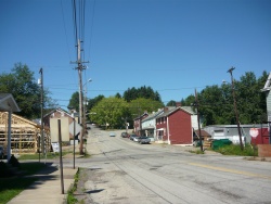
 Main Street | |
|
| |
|
Coordinates: 40°18′38″N 79°39′16″W / 40.31056°N 79.65444°WCoordinates: 40°18′38″N 79°39′16″W / 40.31056°N 79.65444°W Fatal error: The format of the coordinate could not be determined. Parsing failed. | |
| Country | United States |
| State | Pennsylvania |
| County | Westmoreland |
| Incorporated | March 5, 1841 |
| Government | |
| • Type | Borough Council |
| Area | |
| • Total | 0.3 sq mi (0.8 km2) |
| Elevation | 1,155 ft (352 m) |
| Population (2000) | |
| • Total | 221 |
| • Density | 838.3/sq mi (323.7/km2) |
| Time zone | Eastern (EST) (UTC-5) |
| • Summer (DST) | EDT (UTC-4) |
| Zip code | 15611 |
