Difference between revisions of "Centralia Borough, Columbia County, Pennsylvania"
m |
m |
||
| Line 6: | Line 6: | ||
| settlement_type = [[wikipedia:Borough (Pennsylvania)|Borough]] | | settlement_type = [[wikipedia:Borough (Pennsylvania)|Borough]] | ||
| motto = | | motto = | ||
| − | + | ||
| image_skyline = Centralia Skyline.jpg | | image_skyline = Centralia Skyline.jpg | ||
| imagesize = | | imagesize = | ||
| Line 24: | Line 24: | ||
| mapsize1 = 175px | | mapsize1 = 175px | ||
| map_caption1 = Map showing Columbia County in Pennsylvania | | map_caption1 = Map showing Columbia County in Pennsylvania | ||
| − | + | ||
| coordinates_region = US-PA | | coordinates_region = US-PA | ||
| subdivision_type = [[wikipedia:List of countries|Country]] | | subdivision_type = [[wikipedia:List of countries|Country]] | ||
| Line 80: | Line 80: | ||
| footnotes = * The ZIP code for Centralia, 17927, was revoked, so the ZIP code for nearby [[wikipedia:Ashland, Pennsylvania|Ashland, Pennsylvania]] is used. | | footnotes = * The ZIP code for Centralia, 17927, was revoked, so the ZIP code for nearby [[wikipedia:Ashland, Pennsylvania|Ashland, Pennsylvania]] is used. | ||
}} | }} | ||
| + | |||
== Municipality Details == | == Municipality Details == | ||
Revision as of 16:05, 13 April 2014
| Centralia, Pennsylvania | |
|---|---|
| Borough | |
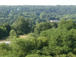
 Centralia as seen from South Street, July 2010 | |
 Map showing Centralia in Columbia County | |
 Map showing Columbia County in Pennsylvania | |
| Country | United States |
| State | Pennsylvania |
| County | Columbia |
| Settled | 1841 |
| Incorporated | 1866 |
| Government | |
| • Mayor | Carl Womer |
| Area | |
| • Total | 0.24 sq mi (0.6 km2) |
| • Land | 0.24 sq mi (0.6 km2) |
| • Water | 0 sq mi (0 km2) 0% |
| Population (2010)[1][2] | |
| • Total | 10 |
| • Density | 42/sq mi (16/km2) |
| Time zone | Eastern (EST) (UTC-5) |
| • Summer (DST) | EDT (UTC-4) |
| ZIP code | 17921 |
| Area code(s) | 570 Exchange: 875 |
| |
Municipality Details
Oil and Gas Activity
Template:Centralia Borough, Columbia, PA-wells
- ↑ "American FactFinder". United States Census Bureau. Retrieved 2011-05-14.
- ↑ "Profile of General Population and Housing Characteristics: 2010: 2010 Demographic Profile Data". U.S. Census Bureau. Retrieved 16 April 2013.