Difference between revisions of "Centralia Borough, Columbia County, Pennsylvania"
m |
|||
| Line 95: | Line 95: | ||
!scope="col" | Violations | !scope="col" | Violations | ||
|} | |} | ||
| + | ==References== | ||
| + | {{Reflist}} | ||
| + | |||
__NOEDITSECTION__ | __NOEDITSECTION__ | ||
Revision as of 00:18, 10 May 2014
| Centralia, Pennsylvania | |
|---|---|
| Borough | |
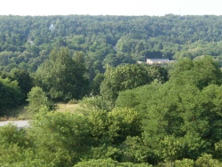
 Centralia as seen from South Street, July 2010 | |
 Map showing Centralia in Columbia County | |
 Map showing Columbia County in Pennsylvania | |
| Country | United States |
| State | Pennsylvania |
| County | Columbia |
| Settled | 1841 |
| Incorporated | 1866 |
| Government | |
| • Mayor | Carl Womer |
| Area | |
| • Total | 0.24 sq mi (0.6 km2) |
| • Land | 0.24 sq mi (0.6 km2) |
| • Water | 0 sq mi (0 km2) 0% |
| Population (2010) | |
| • Total | 10 |
| • Density | 42/sq mi (16/km2) |
| Time zone | Eastern (EST) (UTC-5) |
| • Summer (DST) | EDT (UTC-4) |
| ZIP code | 17921 |
| Area code(s) | 570 Exchange: 875 |
| |
Municipality Details
Oil and Gas Activity
| Well ID | Operator Name | First Permit Date | Spud Date | Unconventional | Horizontal | Producing | Violations |
|---|
References