Difference between revisions of "Northampton County, Pennsylvania"
m |
m |
||
| Line 24: | Line 24: | ||
| publisher = Wikipedia | | publisher = Wikipedia | ||
| url = https://en.wikipedia.org/wiki/Northampton_County,_Pennsylvania | | url = https://en.wikipedia.org/wiki/Northampton_County,_Pennsylvania | ||
| − | | accessdate = 2019-07- | + | | accessdate = 2019-07-25}}</ref> |
}}__TOC__ | }}__TOC__ | ||
<!--== County Well Data == | <!--== County Well Data == | ||
Latest revision as of 14:35, 25 July 2019
| Northampton County, Pennsylvania | ||
|---|---|---|
| ||
 Location in the state of Pennsylvania | ||
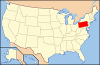
 Pennsylvania's location in the U.S. | ||
| Founded | March 11, 1752 | |
| Named for | Northamptonshire | |
| Seat | Easton | |
| Largest city | Bethlehem | |
| Area | ||
| • Total | 377 sq mi (976 km2) | |
| • Land | 370 sq mi (958 km2) | |
| • Water | 7.7 sq mi (20 km2), 2.0% | |
| Population (Est.) | ||
| • (2018) | 304,807 | |
| • Density | 813/sq mi (314/km²) | |
| Time zone | Eastern: UTC-5/-4 | |
| Website | www.northamptoncounty.org | |
| Footnotes: For infobox source see[1] | ||
Contents
References
- ↑ "Northampton County, Pennsylvania". Wikipedia. Retrieved 2019-07-25.
- ↑ "Oil and Gas Well Pad Report". Pennsylvania Department of Environmental Protection. 2019-05-20. Retrieved 2019-05-21.

