Difference between revisions of "Monroe County, Pennsylvania"
m |
m |
||
| Line 25: | Line 25: | ||
| publisher = Wikipedia | | publisher = Wikipedia | ||
| url = https://en.wikipedia.org/wiki/Monroe_County,_Pennsylvania | | url = https://en.wikipedia.org/wiki/Monroe_County,_Pennsylvania | ||
| − | | accessdate = 2019- | + | | accessdate = 2019-08-13}}</ref> |
}}__TOC__ | }}__TOC__ | ||
== County Well Data == | == County Well Data == | ||
Revision as of 15:00, 13 August 2019
| Monroe County, Pennsylvania | |
|---|---|
|
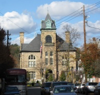
Monroe County Courthouse | |
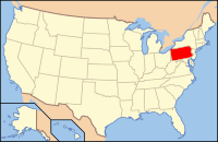
 Location in the state of Pennsylvania | |
 Pennsylvania's location in the U.S. | |
| Founded | April 1, 1836 |
| Named for | James Monroe |
| Seat | Stroudsburg |
| Largest borough | East Stroudsburg |
| Area | |
| • Total | 617 sq mi (1,598 km2) |
| • Land | 608 sq mi (1,575 km2) |
| • Water | 9.0 sq mi (23 km2), 1.5% |
| Population (Est.) | |
| • (2018) | 169,507 |
| • Density | 279/sq mi (108/km²) |
| Congressional districts | 8th |
| Time zone | Eastern: UTC-5/-4 |
| Footnotes: For infobox source see[1] | |
Contents
County Well Data
| Well ID | Municipality | Operator Name | Permit Date | Spud Date | Unconventional | Configuration | License Status |
|---|---|---|---|---|---|---|---|
| 37-089-20001 | Barrett Township | FARMERS GAS & OIL INC | 1962-06-19 | 1800-01-01 | N | Vertical Well | Plugged OG Well |
References
- ↑ "Monroe County, Pennsylvania". Wikipedia. Retrieved 2019-08-13.
- ↑ "Permits Issued Detail Report". Pennsylvania Department of Environmental Protection. 2019-05-20. Retrieved 2019-05-21.
- ↑ "Spud Data Report". Pennsylvania Department of Environmental Protection. 2019-04-30. Retrieved 2019-05-16.
- ↑ "Oil and Gas Well Pad Report". Pennsylvania Department of Environmental Protection. 2019-05-20. Retrieved 2019-05-21.
