Difference between revisions of "Greene County, Ohio"
m |
m |
||
| Line 1: | Line 1: | ||
| + | {{Infobox U.S. County| | ||
| + | county = Greene County | | ||
| + | state = Ohio | | ||
| + | seal = Seal of Greene County Ohio.svg | | ||
| + | founded = May 1, 1803<ref name="odod">{{cite web|url = http://www.odod.state.oh.us/research/FILES/S0/Greene.pdf |title = Ohio County Profiles: Greene County |accessdate = 2007-04-28 |publisher = Ohio Department of Development | format = PDF}}</ref> | | ||
| + | seat wl = Xenia | | ||
| + | largest city = [[wikipedia:Beavercreek, Ohio|Beavercreek]]* | | ||
| + | area_total_sq_mi = 416.26 | | ||
| + | area_land_sq_mi = 413.73 | | ||
| + | area_water_sq_mi = 2.53 | | ||
| + | area percentage = 0.61% | | ||
| + | census yr = 2010 | | ||
| + | pop = 161573 | | ||
| + | density_sq_mi = 390.5 | | ||
| + | time zone = Eastern | | ||
| + | footnotes = *Based on population just within the county.<ref name="pop">{{cite web|url = http://www.osuedc.org/profiles/population/places.php?sid=41&fips=39057 |title = Greene County data (population) |accessdate = 2007-05-10 |publisher = [[wikipedia:Ohio State University|Ohio State University]] Extension Data Center }}</ref> | | ||
| + | web = www.co.greene.oh.us | | ||
| + | named for = General [[wikipedia:Nathanael Greene|Nathanael Greene]] | | ||
| + | ex image = Greene County Courthouse.JPG|150px|Greene County Courthouse | ||
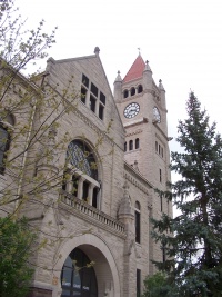
| + | ex image cap = The [[wikipedia:Greene County Courthouse (Ohio)|Greene County Courthouse]] in [[wikipedia:Xenia, Ohio|Xenia]] | ||
| + | | district = 10th | ||
| + | }} | ||
__TOC__ | __TOC__ | ||
== County Details == | == County Details == | ||
Revision as of 18:33, 17 August 2014
| Greene County, Ohio | ||
|---|---|---|
| ||
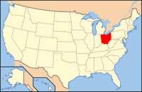
 Location in the state of Ohio | ||
 Ohio's location in the U.S. | ||
| Founded | May 1, 1803[1] | |
| Named for | General Nathanael Greene | |
| Seat | Xenia | |
| Largest city | Beavercreek* | |
| Area | ||
| • Total | 416.26 sq mi (1,078 km2) | |
| • Land | 413.73 sq mi (1,072 km2) | |
| • Water | 2.53 sq mi (7 km2), 0.61% | |
| Population | ||
| • (2010) | 161,573 | |
| • Density | 390.5/sq mi (151/km²) | |
| Congressional district | 10th | |
| Time zone | Eastern: UTC-5/-4 | |
| Website | www.co.greene.oh.us | |
| Footnotes: *Based on population just within the county.[2] | ||
Contents
County Details
==
Oil and Gas Activity
| Well ID | Municipality | Operator Name | First Permit Date | Spud Date | Unconventional | Horizontal | Producing | Violations |
|---|
- ↑ "Ohio County Profiles: Greene County" (PDF). Ohio Department of Development. Retrieved 2007-04-28.
- ↑ "Greene County data (population)". Ohio State University Extension Data Center. Retrieved 2007-05-10.

