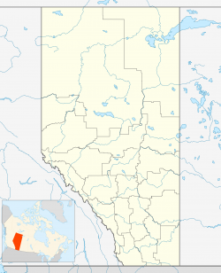
Difference between revisions of "Coaldale, Alberta"
m |
m |
||
| Line 78: | Line 78: | ||
| publisher = Wikipedia | | publisher = Wikipedia | ||
| url = https://en.wikipedia.org/wiki/Coaldale,_Alberta | | url = https://en.wikipedia.org/wiki/Coaldale,_Alberta | ||
| − | | accessdate = 2020- | + | | accessdate = 2020-09-16}}</ref> |
}}__TOC__ | }}__TOC__ | ||
== Municipality Well Data == | == Municipality Well Data == | ||
Revision as of 23:26, 15 September 2020
| Coaldale | |
|---|---|
| Town | |
| Town of Coaldale | |
| Country | Canada |
| Province | Alberta |
| Region | Southern Alberta |
| Census division | 2 |
| Municipal district | Lethbridge County |
| Incorporated | |
| • Village | December 27, 1919 |
| • Town | January 7, 1952 |
| Area (2016) | |
| • Land | 7.99 km2 (3.08 sq mi) |
| Elevation | 863 m (2,831 ft) |
| Population (2016) | |
| • Total | 8,215 |
| • Density | 1,028.5/km2 (2,664/sq mi) |
| Time zone | MST (UTC-7) |
| Forward sortation area | T1M |
| Website | Official website |
| For infobox source see[1] | |
Contents
Municipality Well Data
| UWI | Well Name | Operator Name | License Number | License Issue Date | License Status | Spud Date |
|---|---|---|---|---|---|---|
| 0094201411000 | CANHUNTER LEOPARD 11-14-9-20 | ConocoPhillips Canada Operations ULC | 0236291 | 2000-04-18 | RecCertified | 2000-04-27 |
| 0094201416000 | PCP 16C LEOPARD 16-14-9-20 | Ovintiv Canada ULC | 0185632 | 1996-02-09 | RecCertified | 1996-03-02 |
| 0094201601000 | ERCB 668 CHIN COULEE TH 1-16-9-20 | Unknown Operator/Address - Used by Field Surveillance | B0002147 | 1948-06-15 | RecExempt | 1948-06-15 |
References
- ↑ "Coaldale, Alberta". Wikipedia. Retrieved 2020-09-16.
- ↑ "General Well Data File - Licensing Data". Alberta Energy Regulator. 2020-04-22. Retrieved 2020-05-07.
- ↑ "General Well Data File - Drilling Data". Alberta Energy Regulator. 2020-04-22. Retrieved 2020-05-07.
