Difference between revisions of "Cayuga County, New York"
m |
m |
||
| Line 1: | Line 1: | ||
| + | {{Infobox U.S. County | ||
| + | | county = Cayuga County | ||
| + | | state = New York | ||
| + | | seal = Cayuga County ny seal.png | ||
| + | | founded = 1799 | ||
| + | | seat wl= Auburn | ||
| + | | largest city wl = Auburn | ||
| + | | area_total_sq_mi =864 | ||
| + | | area_land_sq_mi =693 | ||
| + | | area_water_sq_mi =170 | ||
| + | | area percentage = 19.74% | ||
| + | | census yr = 2010 | ||
| + | | pop = 80026 | ||
| + | | density_km2 =44.5 | ||
| + | | web = www.co.cayuga.ny.us | ||
| + | | ex image = Cayuga County Court House Auburn.jpg | ||
| + | | ex image cap = Cayuga County Courthouse | ||
| + | | district = 24th | ||
| + | | time zone = Eastern | ||
| + | | named for = [[wikipedia:Cayuga people|Cayuga people]] | ||
| + | }} | ||
__TOC__ | __TOC__ | ||
== County Details == | == County Details == | ||
Revision as of 18:15, 17 August 2014
| Cayuga County, New York | ||
|---|---|---|
|
Cayuga County Courthouse | ||
| ||
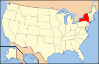
 Location in the state of New York | ||
 New York's location in the U.S. | ||
| Founded | 1799 | |
| Named for | Cayuga people | |
| Seat | Auburn | |
| Largest city | Auburn | |
| Area | ||
| • Total | 864 sq mi (2,238 km2) | |
| • Land | 693 sq mi (1,795 km2) | |
| • Water | 170 sq mi (440 km2), 19.74% | |
| Population | ||
| • (2010) | 80,026 | |
| • Density | 115/sq mi (44.5/km²) | |
| Congressional district | 24th | |
| Time zone | Eastern: UTC-5/-4 | |
| Website | www.co.cayuga.ny.us | |
Contents
County Details
==
Oil and Gas Activity
| Well ID | Municipality | Operator Name | First Permit Date | Spud Date | Unconventional | Horizontal | Producing | Violations |
|---|

