|
|
| Line 74: |
Line 74: |
| | |footnotes = | | |footnotes = |
| | }} | | }} |
| − | {{Infobox settlement
| + | |
| − | |official_name = Asylum Township, Pennsylvania
| + | |
| − | |other_name =
| |
| − | |native_name =
| |
| − | |nickname =
| |
| − | |settlement_type = [[wikipedia:Township (Pennsylvania)|Township]]
| |
| − | |motto =
| |
| − | |image_skyline = Asylum Township.jpg
| |
| − | |imagesize =
| |
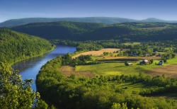
| − | |image_caption = The Susquehanna River near French Azilum
| |
| − | |image_flag =
| |
| − | |flag_size =
| |
| − | |image_seal =
| |
| − | |seal_size =
| |
| − | |image_shield =
| |
| − | |shield_size =
| |
| − | |city_logo =
| |
| − | |citylogo_size =
| |
| − | |image_map = Map of Asylum Township, Bradford County, Pennsylvania Highlighted.png
| |
| − | |mapsize = 250x200px
| |
| − | |map_caption = Map of Bradford County with Asylum Township highlighted
| |
| − | |image_map1 = Map of Pennsylvania highlighting Bradford County.svg
| |
| − | |mapsize1 = 250x200px
| |
| − | |map_caption1 = Map of Bradford County, Pennsylvania
| |
| − | |coordinates_region = US-PA
| |
| − | |subdivision_type = [[wikipedia:Countries of the world|Country]]
| |
| − | |subdivision_name = [[wikipedia:United States|United States]]
| |
| − | |subdivision_type1 = [[wikipedia:Political divisions of the United States|State]]
| |
| − | |subdivision_name1 = [[wikipedia:Pennsylvania|Pennsylvania]]
| |
| − | |subdivision_type2 = [[wikipedia:List of counties in Pennsylvania|County]]
| |
| − | |subdivision_name2 = [[wikipedia:Bradford County, Pennsylvania|Bradford]]
| |
| − | |subdivision_type3 =
| |
| − | |subdivision_name3 =
| |
| − | |subdivision_type4 =
| |
| − | |subdivision_name4 =
| |
| − | |government_footnotes =
| |
| − | |government_type =
| |
| − | |leader_title =
| |
| − | |leader_name =
| |
| − | |leader_title1 =
| |
| − | |leader_name1 =
| |
| − | |leader_title2 =
| |
| − | |leader_name2 =
| |
| − | |leader_title3 =
| |
| − | |leader_name3 =
| |
| − | |leader_title4 =
| |
| − | |leader_name4 =
| |
| − | |established_title = Settled
| |
| − | |established_date = 1793
| |
| − | |established_title1 = Incorporated
| |
| − | |established_date1 = 1814
| |
| − | |area_magnitude =
| |
| − | |unit_pref = Imperial
| |
| − | |area_footnotes =
| |
| − | |area_total_km2 = 68.4
| |
| − | |area_land_km2 = 65.6
| |
| − | |area_water_km2 = 2.8
| |
| − | |area_total_sq_mi =
| |
| − | |area_land_sq_mi =
| |
| − | |area_water_sq_mi =
| |
| − | |area_water_percent =
| |
| − | |population_as_of = 2010
| |
| − | |population_footnotes =
| |
| − | |population_note =
| |
| − | |population_total = 1058
| |
| − | |population_density_km2 = 16.1
| |
| − | |population_density_sq_mi =
| |
| − | |elevation_m =
| |
| − | |elevation_ft =
| |
| − | |postal_code_type =
| |
| − | |postal_code =
| |
| − | |area_code =
| |
| − | |website =
| |
| − | |footnotes =
| |
| − | }}
| |
| | | | |
| | | | |


