Schoharie County, New York
| Schoharie County, New York | ||
|---|---|---|
|
Schoharie County Courthouse | ||
| ||
 Location in the state of New York | ||
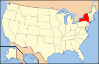
 New York's location in the U.S. | ||
| Founded | 1795 | |
| Seat | Schoharie | |
| Largest town | Cobleskill | |
| Area | ||
| • Total | 626 sq mi (1,621 km2) | |
| • Land | 622 sq mi (1,611 km2) | |
| • Water | 4 sq mi (10 km2), 0.69% | |
| Population | ||
| • (2010) | 32,749 | |
| • Density | 52/sq mi (20/km²) | |
| Congressional district | 19th | |
| Time zone | Eastern: UTC-5/-4 | |
| Website | www.schohariecounty-ny.gov | |
Contents
County Details
==
Oil and Gas Activity
| Well ID | Municipality | Operator Name | First Permit Date | Spud Date | Unconventional | Horizontal | Producing | Violations |
|---|

