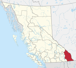
East Kootenay B, East Kootenay, British Columbia
| East Kootenay | |
|---|---|
| Regional district | |
| Regional District of East Kootenay | |
|
Lua error in Module:Location_map at line 185: Unable to find the specified location map definition. Neither "Module:Location map/data/CAN BC East Kootenay" nor "Template:Location map CAN BC East Kootenay" exists. Major communities | |
 Location in British Columbia | |
| Country | Canada |
| Province | British Columbia |
| Office location | Cranbrook |
| Government | |
| • Body | Board of Directors |
| Area | |
| • Land | 27,541.84 km2 (10,633.96 sq mi) |
| Population (2016) | |
| • Total | 60,439 |
| • Density | 2.2/km2 (6/sq mi) |
| Website | rdek.bc.ca |
| For infobox source see[1] | |
Contents
Municipality Well Data
| Well ID | Operator Name | Well Type | License Status |
|---|---|---|---|
| 200D008C082G0500 | DEI | Abandoned | Undefined |
For data sources see[2]
References
- ↑ "Regional District of East Kootenay". Wikipedia. Retrieved 2020-11-05.
- ↑ "Wells Report". B.C. Oil and Gas Commission. 2020-09-21. Retrieved 2020-09-21.