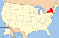
Herkimer County, New York
| Herkimer County, New York | |||
|---|---|---|---|
| |||
 Location in the state of New York | |||
 New York's location in the U.S. | |||
| Founded | 1791 | ||
| Named for | Nicholas Herkimer | ||
| Seat | Herkimer | ||
| Largest village | German Flatts | ||
| Area | |||
| • Total | 1,458 sq mi (3,776 km2) | ||
| • Land | 1,411 sq mi (3,654 km2) | ||
| • Water | 46 sq mi (119 km2), 3.2 | ||
| Population | |||
| • (2010) | 64,519 | ||
| • Density | 46/sq mi (18/km²) | ||
| Congressional districts | 22nd | ||
| Time zone | Eastern: UTC-5/-4 | ||
| Website | www.herkimercounty.org | ||
| Footnotes: For infobox source see[1] | |||
Contents
County Well Data
| Well ID | Municipality | Operator Name | Permit Date | Spud Date | Configuration | Well Status |
|---|---|---|---|---|---|---|
| 31-043-01005 | German Flatts | Remington Standard Typewriter | 1900-01-01 | Vertical | Unknown | |
| 31-043-01036 | Winfield | Unknown | 1921-01-01 | Vertical | Unknown | |
| 31-043-03993 | Warren | New York Natural Gas Co. | 1959-12-16 | Vertical | Unknown | |
| 31-043-04034 | Stark | Millennium Natural Resource Development | 1960-06-28 | Vertical | Inactive | |
| 31-043-19486 | Winfield | F. L. Stead & Associates Inc. | 1985-07-26 | Vertical | Expired Permit |
For data sources see[2]
References
- ↑ "Herkimer County, New York". Wikipedia. Retrieved 2021-07-19.
- ↑ "Public Wells Data". New York State Department of Environmental Conservation. 2019-08-09. Retrieved 2019-08-09.


