Jewell County, Kansas
| Jewell County, Kansas | |
|---|---|
|
Jewell County courthouse in Mankato (2014) | |
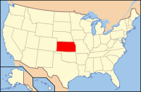
 Location in the state of Kansas | |
 Kansas's location in the U.S. | |
| Founded | February 26, 1887 |
| Named for | Lewis R. Jewell |
| Seat | Mankato |
| Largest city | Mankato |
| Area | |
| • Total | 914 sq mi (2,367 km2) |
| • Land | 910 sq mi (2,357 km2) |
| • Water | 4.6 sq mi (12 km2), 0.5% |
| Population (Est.) | |
| • (2018) | 2,841 |
| Time zone | Central: UTC-6/-5 |
| Footnotes: For infobox source see[1] | |
Contents
County Well Data
| Well ID | Operator Name | Well Status |
|---|---|---|
| 15-089-00001 | Plugged and Abandoned | |
| 15-089-00002 | Plugged and Abandoned | |
| 15-089-00003 | Plugged and Abandoned | |
| 15-089-00004 | Plugged and Abandoned | |
| 15-089-00006 | Plugged and Abandoned | |
| 15-089-00007 | Plugged and Abandoned | |
| 15-089-00008 | Plugged and Abandoned | |
| 15-089-00032 | ||
| 15-089-00034 | ||
| 15-089-00150 | ||
| 15-089-01007 | ||
| 15-089-01009 | ||
| 15-089-01012 | Plugged and Abandoned | |
| 15-089-19000 | Plugged and Abandoned | |
| 15-089-20001 | Mallard Petroleum, Inc. | Plugged and Abandoned |
| 15-089-20002 | Prijatel, Paul | Expired Intent to Drill (C-1) |
| 15-089-20003 | Coastal Oil & Gas Corporation | Plugged and Abandoned |
| 15-089-20004 | Sunflower Land & Oil | Plugged and Abandoned |
For data sources see[2]
References
- ↑ "Jewell County, Kansas". Wikipedia. Retrieved 2020-12-22.
- ↑ "All Wells". Kansas Geological Survey. 2020-10-26. Retrieved 2020-11-18.
