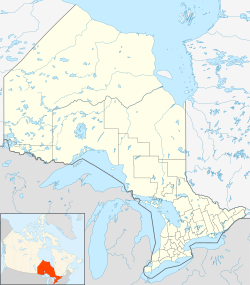
King, York, Ontario
| King | |
|---|---|
| Township (lower-tier) | |
| King Township | |
| Country | Canada |
| Province | Ontario |
| Regional Municipality | York Region |
| Settled | 1800 |
| Incorporated | |
| • Township | 1850 |
| Area | |
| • Total | 333.25 km2 (128.67 sq mi) |
| Population (2016) | |
| • Total | {{#property:P1,082}} |
| • Density | 73.6/km2 (191/sq mi) |
| Time zone | EST (UTC-5) |
| • Summer (DST) | EDT (UTC-4) |
| Forward sortation area | L0G and L7B |
| Area code(s) | 905 and 289 |
| Website | Template:Official URL |
| For infobox source see[1] | |
Contents
Subdivision Well Data
| Well ID | Operator Name | Spud Date | Well Status |
|---|---|---|---|
| N002618 | Strawberry Lane Well | Abandoned Well | |
| N002887 | Ontario Geological Survey | 1982-02-20 | Abandoned Well |
For data sources see[2]
References
- ↑ "King, Ontario". Wikipedia. Retrieved 2020-09-15.
- ↑ "OGSR Library - Wells". Oil, Gas & Salt Resources Library. 2019-06-13. Retrieved 2020-08-07.
