X

Track changes made to this page

If you find this page useful and would like to be notified of changes made to this page, start by inputting your email below.


Privacy policy
Close this window

powered by ChangeDetection

Morris County, Texas

Morris County, Texas
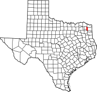
Map of Texas highlighting Morris County
Location in the state of Texas
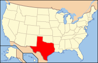
Map of the United States highlighting Texas
Texas's location in the U.S.
Founded 1875
Seat Daingerfield
Largest city Daingerfield
Area
 • Total 259 sq mi (671 km2)
 • Land 252 sq mi (653 km2)
 • Water 6.7 sq mi (17 km2), 2.6%
Population
 • (2010) 12,934
Time zone Central: UTC-6/-5
Website www.co.morris.tx.us
Footnotes: For infobox source see[1]

County Well Data

Well ID Operator Name Well Type Lease
42-343-00042
42-343-30096 LADD PETROLEUM CORP.
42-343-30097 SUNDANCE OIL COMPANY
42-343-30098 GRAHAM EXPLORATION, LTD.
42-343-30099 CZAR RESOURCES, INC.
42-343-30100 OMNI-EXPLORATION, INC.
42-343-30101 Texaco Inc.
42-343-30102 THOR ENERGY OF LOUISIANA, INC.
42-343-30103 GRIMM, JACK F.
42-343-30104
42-343-30105
42-343-30106 DIVERSIFIED LAND & EXPLOR. CO.
42-343-30107 Cities Service Oil & Gas Corp.
42-343-30108 BURK ROYALTY CO., LTD. Oil 14351
42-343-30109 BARROW-SHAVER RESOURCES CO. Oil 15713
42-343-30110 BARROW-SHAVER RESOURCES CO. Oil 15664
42-343-30111 ROSE CITY RESOURCES, LLC
42-343-30112 ROSE CITY RESOURCES, LLC

For data sources see[2]

References

  1. "Morris County, Texas". Wikipedia. Retrieved 2020-12-09. 
  2. "RRC Digital Map Data". Railrod Commission of Texas. 2020-10-15. Retrieved 2020-10-15.