Sawyer County, Wisconsin
| Sawyer County, Wisconsin | |
|---|---|
|
Map of Wisconsin highlighting Sawyer County Location in the state of Wisconsin | |
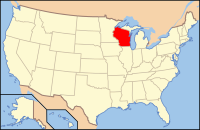
 Wisconsin's location in the U.S. | |
| Founded | 1883 |
| Named for | Philetus Sawyer |
| Seat | Hayward |
| Largest city | Hayward |
| Area | |
| • Total | 1,350 sq mi (3,496 km2) |
| • Land | 1,257 sq mi (3,256 km2) |
| • Water | 93 sq mi (241 km2), 6.9% |
| Population | |
| • (2010) | 16,557 |
| • Density | 13/sq mi (5/km²) |
| Congressional district | 7th |
| Time zone | Central: UTC-6/-5 |
| Website | www.sawyercountygov.org |
Contents
==
Oil and Gas Activity
| Well ID | Municipality | Operator Name | First Permit Date | Spud Date | Unconventional | Horizontal | Producing | Violations |
|---|