Stanley County, South Dakota
| Stanley County, South Dakota | |
|---|---|
|
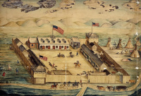
Watercolor drawing of Fort Pierre Chouteau. Dated 1854. | |
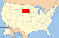
 Location in the state of South Dakota | |
 South Dakota's location in the U.S. | |
| Founded |
1873 (created) 1890 (organized) |
| Named for | David S. Stanley |
| Seat | Fort Pierre |
| Largest city | Fort Pierre |
| Area | |
| • Total | 1,517 sq mi (3,929 km2) |
| • Land | 1,444 sq mi (3,740 km2) |
| • Water | 73 sq mi (189 km2), 4.8 |
| Time zones |
Mountain: UTC-7/-6 western portion |
|
Central: UTC-6/-5 eastern portion | |
| Website | www.stanleycounty.org |
| Footnotes: For infobox source see[1] | |
Contents
County Well Data
For data sources see[2]
References
- ↑ "Stanley County, South Dakota". Wikipedia. Retrieved 2020-11-04.
- ↑ "Petroleum related wells". U.S. Geological Survey. 2014-08-06. Retrieved 2020-09-12.
