York County, Pennsylvania
| York County, Pennsylvania | ||
|---|---|---|
|
[[File:Template:Photomontage|center|200px]] Clockwise from top left: A farm in York County, Golden Plough Tavern, York Friends Meeting House, and welcome sign. | ||
| ||
 Location in the state of Pennsylvania | ||
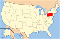
 Pennsylvania's location in the U.S. | ||
| Founded | August 19, 1749 | |
| Seat | York | |
| Largest city | York | |
| Area | ||
| • Total | 911 sq mi (2,359 km2) | |
| • Land | 904 sq mi (2,341 km2) | |
| • Water | 6.5 sq mi (17 km2), 0.7% | |
| Population (Est.) | ||
| • (2018) | 448,273 | |
| • Density | 493/sq mi (190/km²) | |
| Congressional districts | 11th | |
| Time zone | Eastern: UTC-5/-4 | |
| Website | yorkcountypa.gov | |
| Footnotes: For infobox source see[1] | ||
Contents
County Well Data
| Well ID | Municipality | Operator Name | Permit Date | Spud Date | Unconventional | Configuration | License Status |
|---|---|---|---|---|---|---|---|
| 37-133-20001 | Dover | DONELSON CO | 1961-10-23 | 1800-01-01 | N | Vertical Well | Plugged OG Well |
| 37-133-20002 | Paradise | DONELSON CO | 1962-12-18 | 1962-06-09 | N | Vertical Well | Active |
| 37-133-90000 | Monaghan | UNKNOWN OPR | 1800-01-01 | N | Vertical Well | Abandoned | |
| 37-133-90001 | North Codorus | FARMERS GAS & OIL INC | 1800-01-01 | N | Vertical Well | Abandoned |
References
- ↑ "York County, Pennsylvania". Wikipedia. Retrieved 2019-09-02.
- ↑ "Permits Issued Detail Report". Pennsylvania Department of Environmental Protection. 2019-05-20. Retrieved 2019-05-21.
- ↑ "Spud Data Report". Pennsylvania Department of Environmental Protection. 2019-04-30. Retrieved 2019-05-16.
- ↑ "Oil and Gas Well Pad Report". Pennsylvania Department of Environmental Protection. 2019-05-20. Retrieved 2019-05-21.
