Miami County, Ohio
| Miami County, Ohio | ||
|---|---|---|
|
County courthouse in Troy | ||
| ||
 Location in the state of Ohio | ||
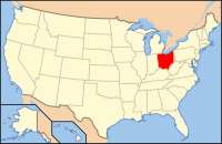
 Ohio's location in the U.S. | ||
| Founded | March 1, 1807 | |
| Named for | Miami people | |
| Seat | Troy | |
| Largest city | Troy* | |
| Area | ||
| • Total | 410 sq mi (1,062 km2) | |
| • Land | 407 sq mi (1,054 km2) | |
| • Water | 3.1 sq mi (8 km2), 0.8% | |
| Population (Est.) | ||
| • (2019) | 106,987 | |
| • Density | 252/sq mi (97/km²) | |
| Time zone | Eastern: UTC-5/-4 | |
| Website | www.miamicountyohio.gov | |
| Footnotes: For infobox source see[1] | ||
Contents
County Well Data
| Well ID | Municipality | Operator Name | Permit Date | Spud Date | Configuration | License Status |
|---|---|---|---|---|---|---|
| 34-109-20001 | Washington Township | HISTORIC OWNER | 1955-06-29 | Vertical | Plugged and Abandoned | |
| 34-109-20002 | Union Township | HISTORIC OWNER | 1955-12-16 | Vertical | Plugged and Abandoned | |
| 34-109-20003 | Lostcreek Township | HISTORIC OWNER | 1958-10-17 | 1958-10-10 | Vertical | Plugged and Abandoned |
| 34-109-20004 | Springcreek Township | HISTORIC OWNER | 1959-02-13 | 1959-02-09 | Vertical | Plugged and Abandoned |
| 34-109-20006 | Lostcreek Township | HISTORIC OWNER | 1959-06-19 | 1959-06-27 | Vertical | Plugged and Abandoned |
| 34-109-20007 | Springcreek Township | HISTORIC OWNER | 1961-10-13 | 1961-11-01 | Vertical | Historical Production Well |
| 34-109-20008 | Staunton Township | HISTORIC OWNER | 1964-10-30 | 1964-12-31 | Vertical | Dry and Abandoned |
| 34-109-20009 | Staunton Township | HISTORIC OWNER | 1964-10-30 | 1964-11-24 | Vertical | Orphan Well - Ready |
| 34-109-20010 | Union Township | HISTORIC OWNER | 1964-12-19 | Vertical | Plugged and Abandoned | |
| 34-109-20011 | Brown Township | HISTORIC OWNER | 1966-05-12 | 1966-05-16 | Vertical | Plugged and Abandoned |
| 34-109-20012 | Brown Township | HISTORIC OWNER | 1966-05-19 | 1966-05-15 | Vertical | Plugged and Abandoned |
| 34-109-20013 | Elizabeth Township | GASVODA ROD | 1994-01-13 | 1994-06-02 | Vertical | Domestic Well |
| 34-109-20014 | Newton Township | WEST BAY EXPLORATION COMPANY56 | 2012-02-24 | 2012-06-26 | Vertical | Final Restoration |
| 34-109-60001 | Concord Township | HISTORIC OWNER | 1900-04-15 | Vertical | Dry and Abandoned | |
| 34-109-60003 | Monroe Township | HISTORIC OWNER | 1900-06-01 | Vertical | Dry and Abandoned | |
| 34-109-60004 | Newton Township | HISTORIC OWNER | 1900-01-01 | Vertical | Historical Production Well | |
| 34-109-60005 | Concord Township | HISTORIC OWNER | 1900-01-01 | Vertical | Historical Production Well | |
| 34-109-60006 | Newton Township | HISTORIC OWNER | 1900-01-01 | Vertical | Historical Production Well | |
| 34-109-60007 | Newton Township | HISTORIC OWNER | 1900-01-01 | Vertical | Historical Production Well | |
| 34-109-60008 | Newton Township | HISTORIC OWNER | 1900-01-01 | Vertical | Historical Production Well | |
| 34-109-60010 | Washington Township | HISTORIC OWNER | 1900-01-01 | Vertical | Historical Production Well | |
| 34-109-60011 | Washington Township | HISTORIC OWNER | 1900-01-01 | Vertical | Historical Production Well | |
| 34-109-60017 | Washington Township | HISTORIC OWNER | 1900-01-01 | Vertical | Historical Production Well | |
| 34-109-60018 | Washington Township | HISTORIC OWNER | 1900-01-01 | Vertical | Historical Production Well | |
| 34-109-60019 | Washington Township | HISTORIC OWNER | 1900-01-01 | Vertical | Historical Production Well | |
| 34-109-60020 | Washington Township | HISTORIC OWNER | 1900-01-01 | Vertical | Historical Production Well |
For data sources see[2]
References
- ↑ "Miami County, Ohio". Wikipedia. Retrieved 2021-01-11.
- ↑ "Risk Based Data Management System". Ohio Department of Natural Resources. 2020-11-16. Retrieved 2020-11-16.

