Sandusky Township, Sandusky County, Ohio
| Northwood, Ohio | |
|---|---|
| City | |
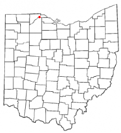
 Location of Northwood, Ohio | |
 Location of Northwood in Wood County | |
| Country | United States |
| State | Ohio |
| County | Wood |
| Area | |
| • Total | 8.57 sq mi (22.20 km2) |
| • Land | 8.56 sq mi (22.16 km2) |
| • Water | 0.01 sq mi (0.03 km2) |
| Elevation | 614 ft (187 m) |
| Population (2010) | |
| • Estimate (2019) | 5,434 |
| ZIP code | 43619 |
| Area code(s) | 419 |
| Website | http://www.ci.northwood.oh.us/ |
| For infobox source see[1] | |
Contents
Municipality Well Data
| Well ID | Operator Name | Permit Date | Spud Date | Configuration | License Status |
|---|---|---|---|---|---|
| 34-143-20025 | HISTORIC OWNER | Vertical | Plugged and Abandoned | ||
| 34-143-20030 | HISTORIC OWNER | Vertical | Plugged and Abandoned | ||
| 34-143-20127 | HISTORIC OWNER | 1965-01-29 | 1965-02-12 | Vertical | Plugged and Abandoned |
| 34-143-20331 | FO ENERGY LLC | 2019-07-30 | Well Permitted | ||
| 34-143-60233 | EMERGENCY PLUGGING | 2010-07-09 | Vertical | Final Restoration | |
| 34-143-60234 | EMERGENCY PLUGGING | 2010-07-09 | Vertical | Final Restoration | |
| 34-143-60235 | EMERGENCY PLUGGING | 2010-07-09 | Vertical | Final Restoration | |
| 34-143-60390 | HISTORIC OWNER | 1900-01-01 | Vertical | Orphan Well - Ready | |
| 34-143-90381 | HISTORIC OWNER | 1902-05-16 | Vertical | Unknown status | |
| 34-143-90395 | HISTORIC OWNER | 1902-01-08 | Vertical | Unknown status | |
| 34-143-90412 | HISTORIC OWNER | 1900-01-01 | Vertical | Unknown status | |
| 34-143-90424 | HISTORIC OWNER | 1900-01-01 | Vertical | Unknown status | |
| 34-143-90427 | HISTORIC OWNER | 1903-09-16 | Vertical | Unknown status | |
| 34-143-90434 | HISTORIC OWNER | 1903-01-24 | Vertical | Unknown status | |
| 34-143-90446 | HISTORIC OWNER | 1903-12-08 | Vertical | Unknown status | |
| 34-143-90449 | HISTORIC OWNER | 1900-01-01 | Vertical | Unknown status | |
| 34-143-90450 | HISTORIC OWNER | 1900-01-01 | Vertical | Unknown status | |
| 34-143-90454 | HISTORIC OWNER | 1905-06-12 | Vertical | Unknown status | |
| 34-143-90460 | HISTORIC OWNER | 1900-01-01 | Vertical | Unknown status | |
| 34-143-90461 | HISTORIC OWNER | 1900-01-01 | Vertical | Unknown status | |
| 34-143-90899 | HISTORIC OWNER | 1900-01-01 | Vertical | Unknown status | |
| 34-143-90962 | HISTORIC OWNER | 1900-01-01 | Vertical | Unknown status | |
| 34-143-90966 | HISTORIC OWNER | 1904-05-09 | Vertical | Unknown status | |
| 34-143-90980 | HISTORIC OWNER | 1900-01-01 | Vertical | Unknown status |
For data sources see[2]
References
- ↑ "Northwood, Ohio#". Wikipedia. Retrieved 2021-01-12.
- ↑ "Risk Based Data Management System". Ohio Department of Natural Resources. 2020-11-16. Retrieved 2020-11-16.